Travel Using Google Maps
How to use Google Maps unconventionally to do a virtual tour and know your surroundings!
What do you use Google Maps for?
I am guessing that Google Maps is used as a GPS in most cases. Sometimes, people might also use it to look up places and see reviews of them. But Google Maps can be used in more ways than just this. You could incorporate it into your daily life and use it to help yourself even more through unconventional ways!
In this blog, I will give everyone a tutorial on using Google Maps for planning trips through a hypothetical situation.
Hypothetical Situation: An international student has been accepted to the Arizona State University. The student knows that he will be staying in the dorms and that’s all he knows… He knows nothing more since he didn’t do any sort of virtual tour of the University and hasn’t yet visited the University as he is an international Student. How can the student explore the University in the comfort of his home and make plans for the University?
Note: My Google Maps tutorial can still be useful even if you aren’t a University Student. I am just using the Hypothetical Situation to help me explain how Google Maps can be used.
Let’s see!
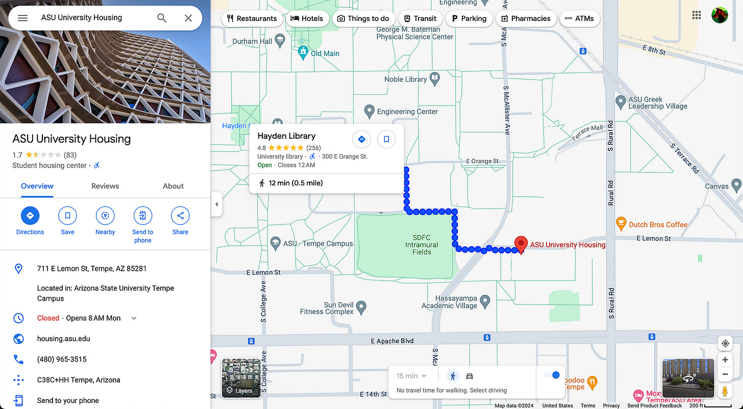
First, the student would likely go ahead and search for the housing facility:
Now, let’s click the Google Maps option on the top right.
Well… Doesn’t the student housing seem to be a bit remote? All the crucial campus buildings seem quite some distance away! For example, the Hayden Library seems to be quite some distance. That might be some trouble considering how the Library is considered an important part of student life! But, we don’t really know how far it is… Right? Why don’t we find out?
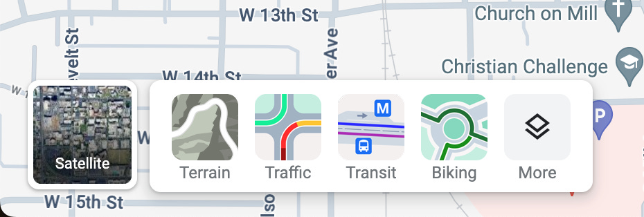
In the bottom left, hover over the Layers option and then click More!
Let’s try the travel time Map Tools and see what happens!
Using the first Map tool(Travel time), we can hover over the Hayden Library and obtain the distance which is 0.5 miles. Going to the library won’t be too much trouble then since a 12-minute walk is not too much of a hassle!
You might have noticed that the Dutch Bros Coffee seems quite close. Perhaps, the Coffee Shop might be the go-to place for the student due to the close distance.
Now, Back to the Hayden Library… If the student is in a hurry, he could decide to take a Bus. In fact, there is an option that allows you to check Bus stops in Google Maps and the option is the Transit option!
From here, we can see that Bus stops are available from both sides of the road. This is amazing!
But looking again, the bus option is likely not the best option for the student since the bus stops are not too close to most of the buildings. The waiting time, travel time by bus, and finally walking in the end to reach the exact location might be less convenient than just walking throughout the journey.
Also, doesn’t the Google Maps look a bit bland? Let’s select the Satellite option in the bottom left and see what happens!
A lot more can be seen and everything seems to be a lot more packed! I have another surprise other than just a Satellite image, you could also check out the building as if you were flying a drone! This can be done by clicking the Globe View option at the bottom:
Note: The Globe View might not work as it should, depending on the country you are using it in.
We have been talking a lot about Hayden Library, why don’t we check it out?
This seems slightly lacking… We can use Ctrl or cmd + holding and moving the mouse to see a better view:
Now, we know how the library looks without even going there physically! And this is all done by Google Maps.
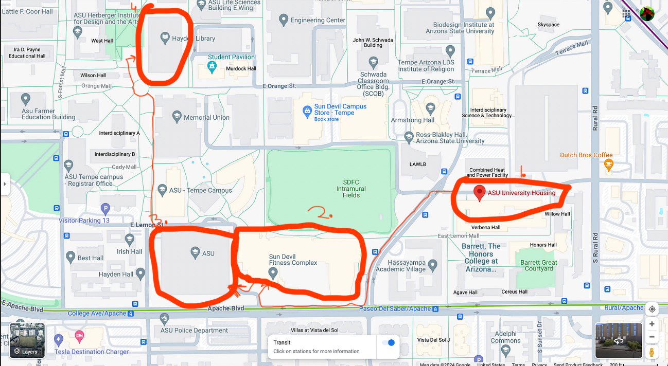
The blog wouldn’t be complete without a rough plan for the student. Using Google Maps, I have highlighted and marked some buildings which I think might be important.
First, the student would be at the ASU Housing(1.). Then perhaps if the student does fitness, he could travel to the Sun Devil Fitness Complex(2.) to do fitness for the morning.
Note: I have assumed that ASU is the exact place where the teachings occur(for convenience) although that might not be the case.
Next, after a fitness session, he would go to the ASU(3.) to participate in lectures and learn. The studying probably doesn’t end there since the student will perhaps have to revise. For this, the student could travel to the Hayden Library(4.). After revision in Hayden Library, the student might go home, or go to some nearby shop like Starbucks to buy some tasty food as shown below.
I hope that you learned a lot about how you could use Google Maps to aid you with the help of this example and can now use Google Maps to sometimes help you with planning since it can be used to also find many things in your vicinity such as close-by shops as shown above.


